Eight beautiful glacial lakes make up the mountain eyes of Zelengora
Decorated with coniferous forests, gorgeous glacial lakes, and spacious mountain pastures, Mount Zelengora rightfully holds the title of the most beautiful and tame mountain of the Dinarid. But what makes Zelengora special are its “mountain eyes” – pure glacial lakes located at the foot of its peaks, between 1,380 and 1,650 meters above sea level.
On Zelengora, an important part of the Sutjeska National Park, you can find as many as eight of them, whose waters are so clear that they reflect the tops of the surrounding mountains. In this article, we singled out three: Orlovačko Lake, Gornje Bare, and Donje Bare.
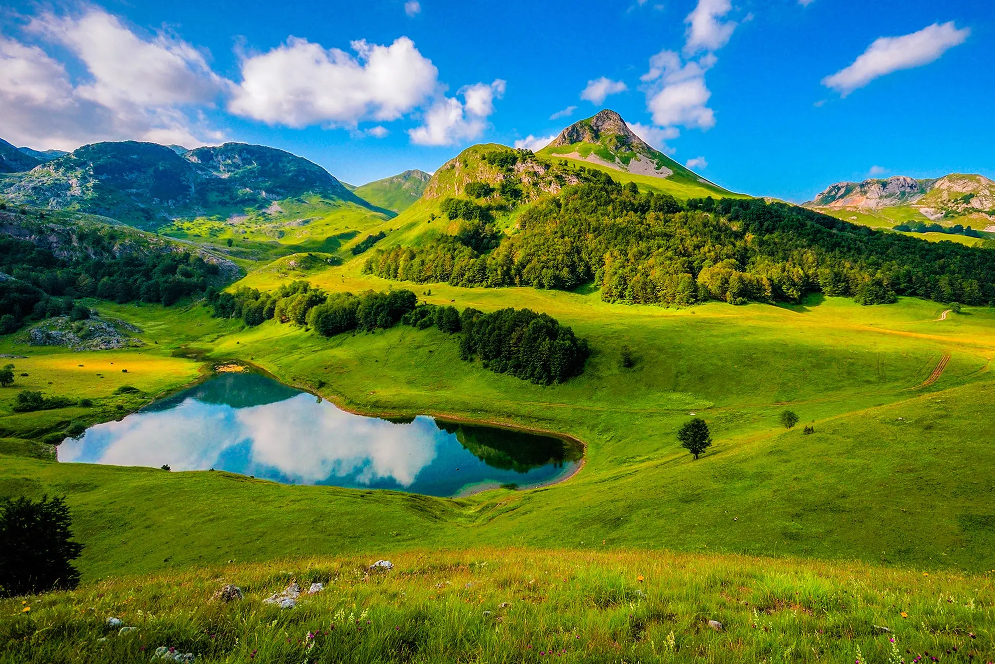
Zelengora, Photo: Gagi.lyu, CC BY-SA 4.0
ORLOVAČKO LAKE
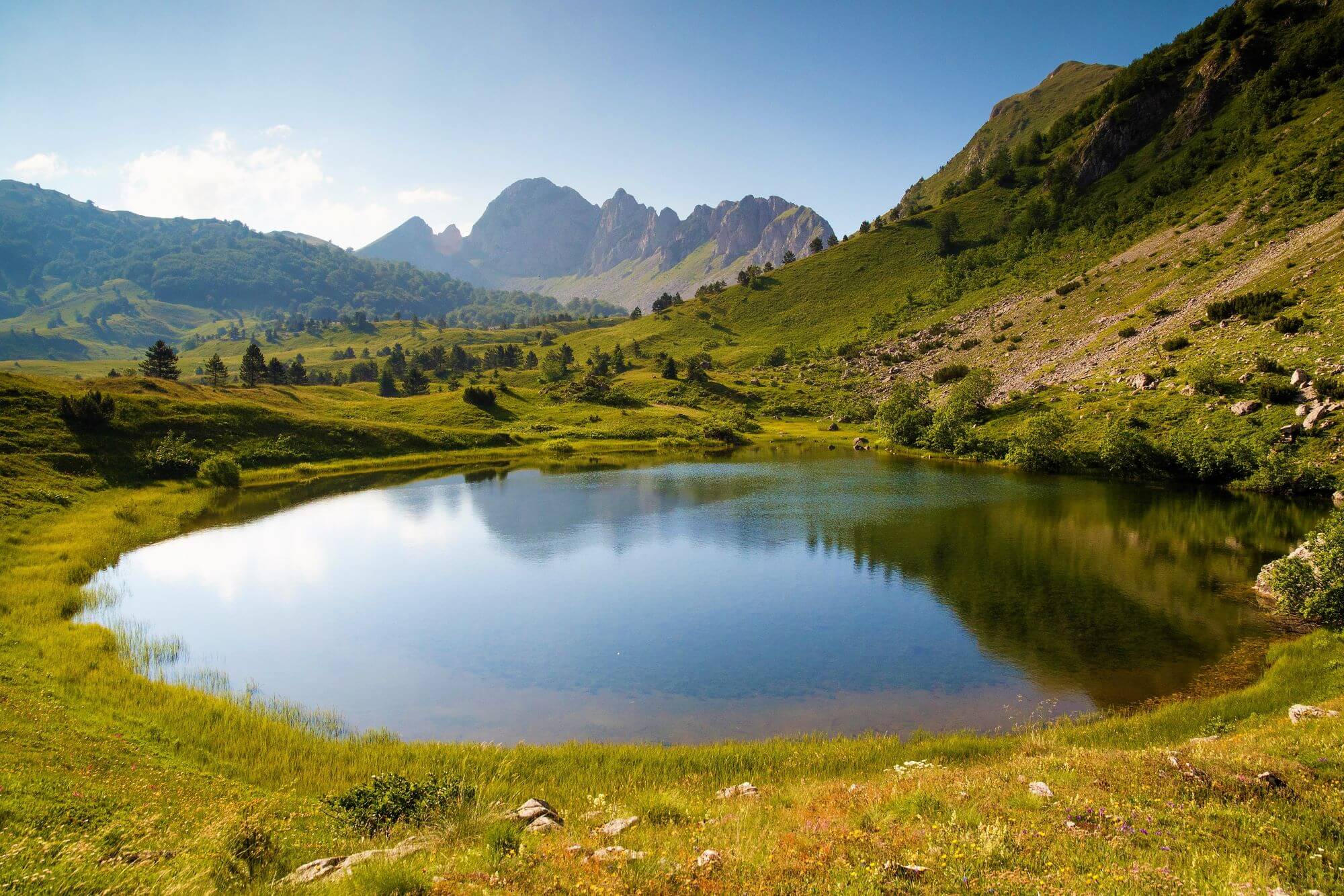
Orlovačko lake, one of the most popular of all eight lakes, is situated 1438 meters above sea level. This beautiful lake is about 350 meters long, about 100 meters wide, and its average depth is about 5 meters, which makes it the third largest. Two species of trout live in it.
Surrounded by the peaks of Orlovac and Orlovača, after which it got its name, the lake is additionally embraced by the peaks of Bregoč, Stog, and Ljeljen.
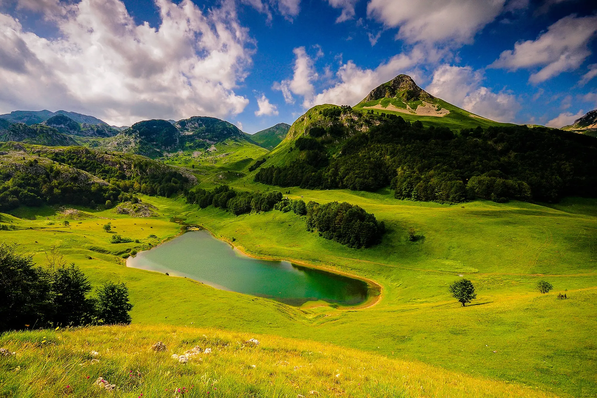
Orlovačko lake, Zelengora, Photo: Boris Petkovic , CC BY-SA 4.0
Donje Bare
Donje Bare Lake is located at the foot of the northeastern side of Tovarnica with the top of Planinica (1722 m.a.s.l.). Located at about 1,500 meters above sea level, the lake is 200 meters long and about 140 meters wide, and its depth reaches over 4 meters. It draws its source from several sources, and it is also home to trout, enjoying its perfectly clean water.
It is surrounded by beautiful rows of pine trees, pastures, and peace. That irresistible beauty also won the heart of former Yugoslav president Josip Broz Tito, who had a mountain house near this lake.
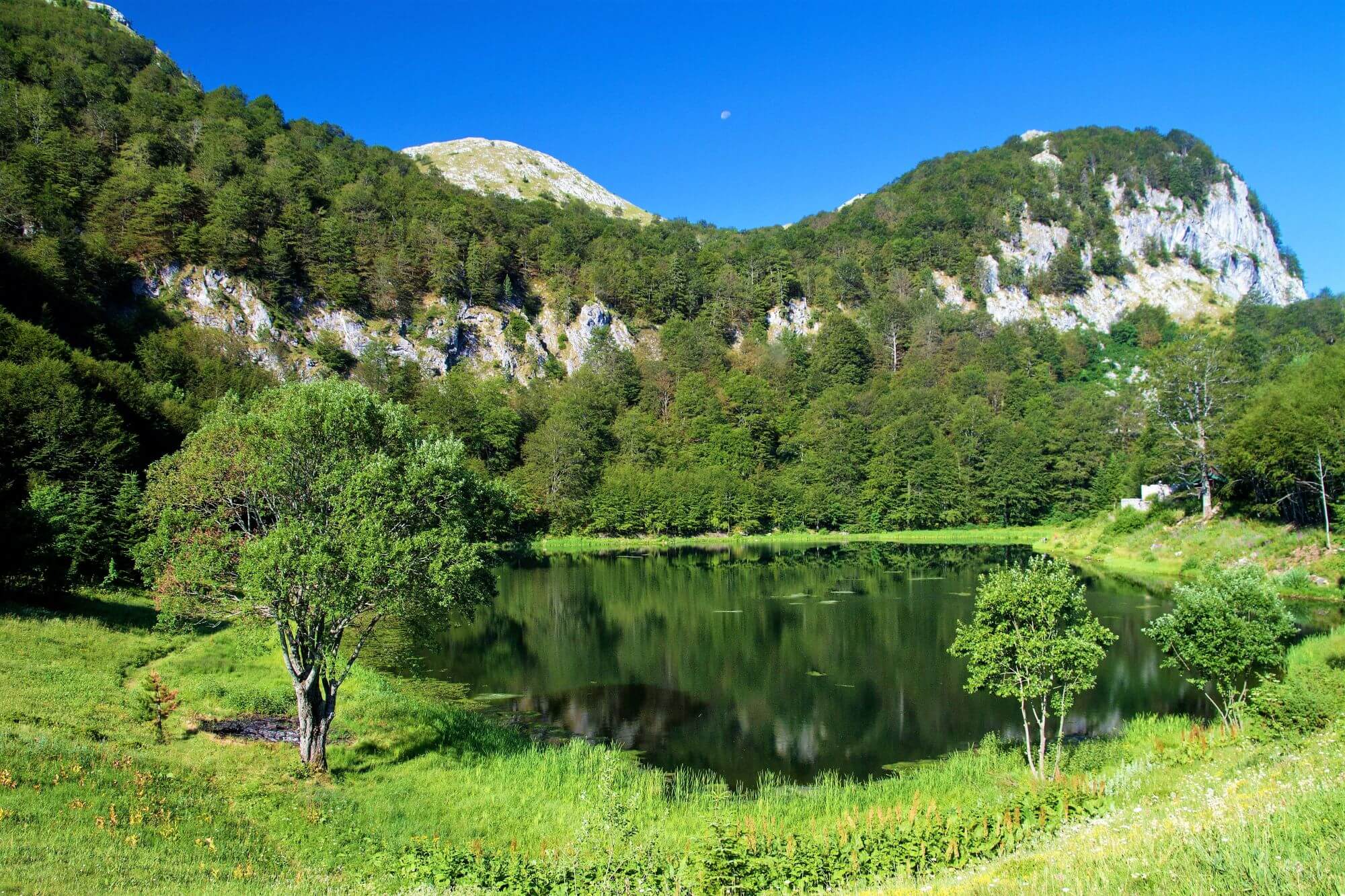
NP Sutjeska, Lake Donje Bare, Photo: Geza Farkas, Dreamstime.com
GORNJe Bare
When you reach Donje Bare Lake, from there, you can take an additional path of about 3 kilometers that will take you to Gornje Bare Lake. It is located on the eastern slopes of Uglješina peak (1858 meters above sea level), Tovarnica mountain massif, between the peaks of Dobra (1795 meters above sea level) and Planinica (1722 meters above sea level), and from the northeast it is surrounded by Medvjeđe brdo with the peaks of Mala and Velika Siljevica (1710 meters and 1720 meters above sea level).
It is only about 150 meters long and 80 meters wide, and its depth reaches about 2 meters. As it is located at an altitude of 1,640 meters above sea level, in addition to the pleasant ambiance, it is also considered an important navigation point.
NP Sutjeska, Lake Gornje Bare, Photo: Geza Farkas, Dreamstime.com
If you find yourself in Zelengora, then be sure to visit the others: Kotlaničko Lake, Štirinsko Lake, Black and White Lakes, and Jugovo Lake, the artificial one, from which Orlovačko Lake is only one kilometer away.
Sara Sedić
I plan to live in the moment :)

Comments
Sara Sedić
Hi! Yes, here are the direct links to the lakes on Google maps:
– Orlovačko lake – https://maps.app.goo.gl/MYZhELAHmmhTe1R96
– Gornje Bare lake – https://maps.app.goo.gl/rKEnFubygUNuEYtS7
– Donje Bare lake – https://maps.app.goo.gl/3w5hMen7w1MM9uaJ8
– Štirinsko lake – https://maps.app.goo.gl/dyPmvMSHKRVh5pio6
– Videško lake – https://maps.app.goo.gl/VU7993EvMjQBMjtG6
– Kotlaničko lake- https://maps.app.goo.gl/hQJUxA4cmDkJ7LfXA
– Kladopoljsko lake- https://maps.app.goo.gl/VqeRBF39JtTNm7a17
– Black lake – https://maps.app.goo.gl/oeAazkkonGhLwuDm7
– White lake – also called Green lake – https://maps.app.goo.gl/a2go8vgYCcbYUZfA9
– Jugovo lake – https://maps.app.goo.gl/kfN713d7ujP5tvb5A
yinn
HI Sara,
We have plan to explore Bosnia somewhere in 3rd week of Sept this year. The Zelengora lakes are one of the top for autumn hunting. Could you share the exact location as its quite hard to find it in google maps.